Day six: Crackington. Jan4th, 2007.
I managed to pick the only dry day of the week for stage six. This latest stage, just a few days into the new year proved that this walk isn’t just a one year wonder. I can’t deny the fact that I’m a little disappointed it hasn’t taken off more. I am perhaps not appealing to the right readership; those people who like reasonably (but not very!) well written pieces about walking in pointless places. But where to find such people? Or maybe the whole thing is too drawn out? Quite Possibly.
Back to the walking. I arrived in Crackington Haven at 8.52am and paid the extortionate three pounds for an ‘all day’ ticket in the sea front car park. On looking at my ticket, I noticed the expiry time was 6.52pm. Not all day, is it, Mr Parking Metre?
Crackington Haven was as devastated as Boscastle in the late summer floods of 2004. It didn’t make the headlines simply because it is a much smaller settlement. However a group of tourists in the beach café could well have made a disaster a tragedy had they not evacuated the café at the right time which is located by the river. Crackington in 2007 doesn’t have any scars to show from the rains which caused water strong enough to wash to wash cars off the A39. The most impressive feature must be the 100 metre vertical cliffs. There are higher cliffs in Cornwall, but I’m not sure I have seen any that go up so steeply.
.JPG)
My first task was to put one heavy leg (energetic game if badminton the day before) in front of the other and get up this hill. The top provided fantastic views of the village and the coast in both directions.
.JPG) A short trip inland brought me to St Genny’s Church, a 15th century small church which has a cliff top location similar to Morwenstow church. Apparently the church suffered greatly when the oak pews were changed for pine ones in the 18th century. Now that was a silly idea. There was no footpath sign where the map showed me next, and even though it went through the garden of the very expensive looking St Genny’s House, I thought I’d give it a try. ‘No-one will be at home’ I thought. I was wrong – there were seven cars parked, including two jags! I noticed a stile at the bottom of garden, and, assuming it wasn’t for private use, climbed over it and found myself in some proper good walking countryside. Legs feeling very heavy at this point, but I managed to get them over the stile.
A short trip inland brought me to St Genny’s Church, a 15th century small church which has a cliff top location similar to Morwenstow church. Apparently the church suffered greatly when the oak pews were changed for pine ones in the 18th century. Now that was a silly idea. There was no footpath sign where the map showed me next, and even though it went through the garden of the very expensive looking St Genny’s House, I thought I’d give it a try. ‘No-one will be at home’ I thought. I was wrong – there were seven cars parked, including two jags! I noticed a stile at the bottom of garden, and, assuming it wasn’t for private use, climbed over it and found myself in some proper good walking countryside. Legs feeling very heavy at this point, but I managed to get them over the stile.I found my way up to Higher Tresmorn Farm, then took a track leading into fields south for about a mile to the hamlet of Coxford, just six houses with a Methodist church at the crossroads just beyond. I was expecting it to be Coxford Methodist Church, but it was in fact Tremayna Methodist Church, named after the even smaller settlement (just a farm basically) slightly further on.
 The church was in good nick, and led me to marvel about how they can keep a Methodist church going in virtually the middle of nowhere. I descended an extremely steep and tiny lane (which a van was reversing back up – tractor congestion) and came to Mineshop, almost one of my settlements, but in fact just a group of holiday cottages. Appropriately, there were some tourists packing up from their Christmas break. As I walked past, a little girl threw a welly at a man, premably her dad. The climb up to Lower Crackington was very steep and muddy and reduced me to my t-shirt (yes, in January). I reckon a 4x4 would have managed it just about.
I reckoned the five or six houses in Lower Crackington were each worth at least half a million pounds. Just up the road, Middle Crackington was the largest population centre of the day (and my biggest since Bude). Around 3 or 400 fairly nice homes on a modern estate. I walked out of the village as far as Brockhill Methodist Church. A church about a mile as the crow flies from Tremayna Methodist, but this time with a population to sustain it (a population that wouldn’t have been there when the church was built). Backtracking, I passed through Higher Crackington, where the village amenities can be found. Leaving the Crackingtons, I went along a path which had been given ‘gold path’ status by Cornwall County Council. Not sure what this means, but it was a nice path, which led me to Rosecare, a very picturesque hamlet with great coastal views, some horses and a farm which – like so many – had turned to tourism to keep it going.

My direction went from heading north east to south east as I zig-zagged across the Cornish countryside. Progress was slow, but I knew I had a lot of road to come, so I would speed up. Next up was the oddly-named Pencuke, a hamlet which was a bit rough around the edges – unusual for this area, I thought. I sat down here next to the road and had my cheese and pickle sandwiches.
My next stage was to include, for the first time, a part which had no right of way shown on the map. The map showed a group of trees before which the footpath stopped. In fact, my problems began before this where the gaps in the hedges had been blocked off. I climbed over two hedges with just a few small bramble cuts to show for my efforts. Getting through the trees was actually very easy. I was nervous approaching Small Hill Barton as I knew it wasn’t on a right of way. I was even more nervous – to the point of almost urinating – when, on arrival at the farm, I was surrounded by six farm dogs, barking ferociously. The farm explained that they were just surprised to see anyone out in ‘this weather’. What weather? I thought, and headed up to the A39, limbs intact. The section of the A39 I had to walk was a dead straight, dead boring mile or so. The rush of cars passing me at up to 80mph only a metre or so from me was quite exciting. At least I wouldn’t feel anything if one hit me at that speed. At least I’d hope not.
The dead straight section ended at Wainhouse Corner, with a settlement which has the same name. It contains, allegedly, the last pub for 13 miles, and has grown exponentially from the original hamlet of a few houses to become a village of 50 houses or so.
For once, I was thankful to be on roads. Although I try to plan as much as possible off-road, progress is slower, mainly because of the need to navigate. I turned right at Wainhouse Corner and walked the mile and a half down to Jacobstow. This village was the find of the day. A beautiful, quiet village away from all the hussle and bussle of modern life. It also had local amenities, including a primary school. What a great place to bring up kids. Another plus was that the church was open, the first one I had found for a while, so I could go in and have a nosy, as well as sign the guest book and publicise my blog! I noticed I was the first person to sign since early November last year.
.JPG)
Jacobstow was the furthest away from the car I would get, and I was getting into the afternoon, so I needed to get moving quickly. I came south for about a mile and found yet another isolated Methodist church, this one called Eden. The fact that these churches remain open is surely a testimony to the strong Christian tradition in this area.

I continued south, heading towards what I thought would be Tregune farm. It turned out to be a very small settlement, and therefore qualified as one of my places. South a bit more to Trevillian Farm where I turned right, along a track. This was to be my last off-road section of the day, as I knew I wouldn’t have time (again) to head back along the coast path before nightfall. I crossed successive fords, the first the River Ottery and immediately after it, a tributary of the Ottery. I continued up the track, reaching, once again, the A39. Right, then immediately left to take me along a two mile exposed stretch of road, along which I had a constant strong wind in my face. I made good time though, and arrived in half an hour or so at my penultimate settlement, Tresparrett Posts, eight or so houses at a staggered crossroads.
Turning right, then after a couple of hundred yards, left, took me down to Hill, six or so houses on a road that I reckoned the residents of Hill had to themselves. I passed the footpath which would have taken me back to the coast, but because of time restraints, made my way back to Crackington Haven. On entering the coastal village, I was stopped by a white van man who asked me if I knew the local area. I said no. What a stupid answer – after today’s walk I probably knew the area better than people who had been living in Crackington for 50 years! It was probably the bowels talking as I was desperate for the loo.
A very enjoyable and more manageable day. If I ever move to North Cornwall, Jacobstow will be very high on my list of places to live.
Day six stats:
Places visited 13 (total 48): Crackington Haven (GR 143968); St Gennys (149972); Coxford (162968); Lower Crackington (158957); Middle Crackington (155956); Higher Crackington (155954); Rosecare (167958); Pencuke (164945); Wainhouse Corner (182954); Jacobstow (198958); Trengune (190934); Tresparrett Posts (149933); Hill (149947)
Altitude gained: 785m (total 3,700m)
Highest altitude: 203m (near Tresparrett Posts)
Total distance walked: 17 miles (cumul 100 miles), 11 on-road (cumul 58), 6 off-road (cumul 42)
Started walking: 9am. Finished walking: 4.15pm
Map used: OS 111
Interesting links:
http://www.cornwall-online.co.uk/north-cornwall/crackhav.htm
http://www.coombebarton.co.uk/
http://www.thisisnorthcornwall.com/crackington_haven.html
http://www.stgennys.co.uk/
http://www.mineshop.co.uk/
http://www.northcornwallholidays.com/
posted by Dan @ 11:59
6 comments
![]()
![]()
 A small petrol tanker was blocking the southern access to the village as he refused to risk the steep, icy descent. I knew time would be against me as this was just about the shortest day of the year, so I didn’t stick around. I found my way up the valley, passing fairy-tale houses and crossing icy bridges to some fields which brought me to Tregole, settlement number two.
 I had seen this church many times as it is right on the main road (well, not literally), and had decided that it was one of the ones that must be due for closure. However, on closer inspection, I could see that – in spite of the bumpy roof – recent work had been done, included new double glazed windows and the inside (which I could see through the new windows) was well kept. It had a capacity of about fifty, surely as much as the entire population of its catchment area I thought.
 Looking around I could see that all the houses would have been completely flooded to the point of the flood reaching the first floor of some of them. The bridge would also have been completely submerged. I left Newmill through a big green gate clearly designed to give privacy to the people in the property behind it, but with nonetheless access to two rights of way. I took the one heading up over the fields to the A39. It was midday and I was surprised at the amount of frost still on the ground.
 I walked up the A39 to the hamlet of Bangors, which had a surprisingly large and active looking Methodist church. The Sunday school appeared bigger than the main church. I turned left and headed down to the hamlet of Poundstock. It’s a road which goes to nowhere (just back around to the A39), so it is extremely quiet. Poundstock was my only parish church of the day, and I was disappointed to find it locked. There was a number to call to get it open, but it seemed too much hassle. Of much more interest was the fourteenth century medieval guild house, which is the only surviving one of its kind in Cornwall.
 There is a proposed restoration project so it can once again be used for community events. I had my cheese and pickle sandwiches by the house and saw not another car or human being while I was there.
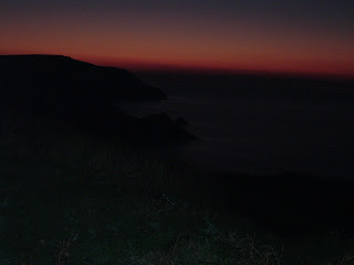 If only I had got here an hour earlier I might have seen a spectacular sunset.